Wired published an article showing the work of Dustin Cable at University of Virginia’s Weldon Cooper Center for Public Service. Mr. Cable has plotted the racial make up of America using data from the 2010 Census.
His work is almost art, it is so mesmerizing. However, as Wired points out, our country and our communities remain greatly divided.
To illustrate, here are two screenshots from the area near my home.

The mostly green triangle near Lucasville is approximately the location of the Southern Ohio Correctional Facility.
The red arrow points toward two red dots seemingly randomly located in an otherwise rural white area.
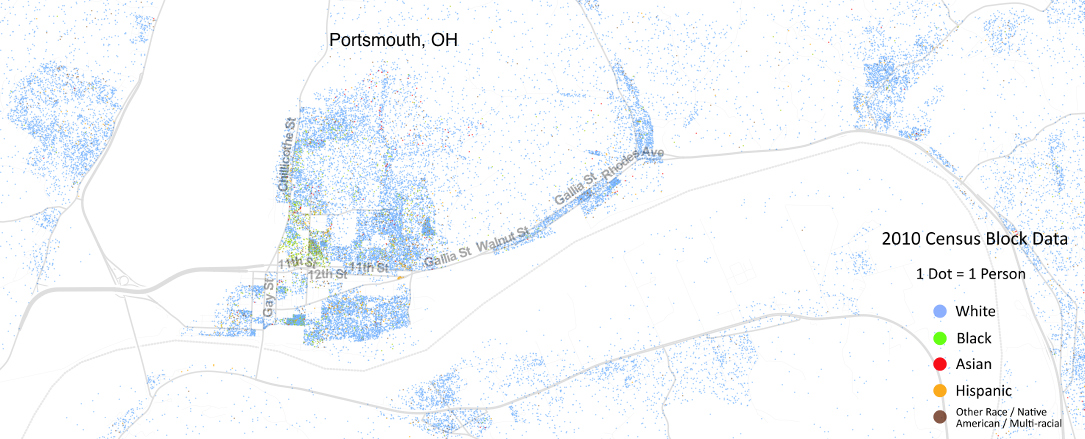
In Portsmouth, you can see the relatively well defined White and African-American neighborhoods, along with a small Hispanic community.
What I find interesting is how the Asians are dispersed throughout the rest of the population.
I don’t have any conclusions to draw here but it is interesting to see on a map how a community I perceive as being almost exclusively white does have more diversity that appears on the surface.
You can check out the map for yourself here and read the Wired article here.